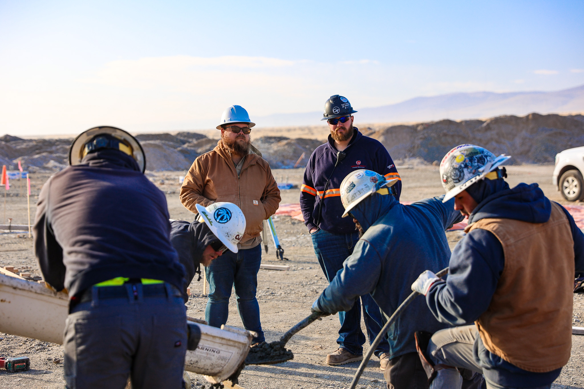
In the mission-critical world of utility and power infrastructure, efficiency is more than a cost-saving measure—it’s a requirement for grid stability and project success. However, traditional civil earthwork processes—relying on manual survey teams, expensive change orders, and delayed progress reports—are often a bottleneck.
At Grade Tech Power Services, we recognized that the blueprint for success needed an upgrade. By integrating advanced drone mapping and photogrammetry into our workflow, we’ve transformed how we manage earthwork. The result? Projects completed faster, with greater precision, and substantial cost savings for our utility clients—a figure that has topped $1.7 million and counting on a single large-scale project.
The Problem: Why Traditional Surveying Costs You Time and Money
Before integrating drones, utility civil projects—especially large substation or solar sites—faced three persistent challenges:
- Time-Consuming Surveys: Traditional ground surveys require a team to physically navigate the site, often taking days or even weeks for initial topography and progress checks. This is time the civil crew is waiting or working with outdated data.
- Inaccurate Volume Calculations: Calculating cut/fill volumes manually or with older software is prone to error. Overestimating or underestimating earth movement leads to costly mistakes, either through excess hauling fees or budget-busting change orders.
- Communication Gaps: Data from the field often takes days to process and reach the client, causing coordination delays with other contractors (e.g., electrical, structural).
The Solution: Precision and Speed from Above
Grade Tech’s drone program, powered by industry leaders like Propeller Aero and DJI, replaces slow, manual processes with rapid, high-definition aerial intelligence.
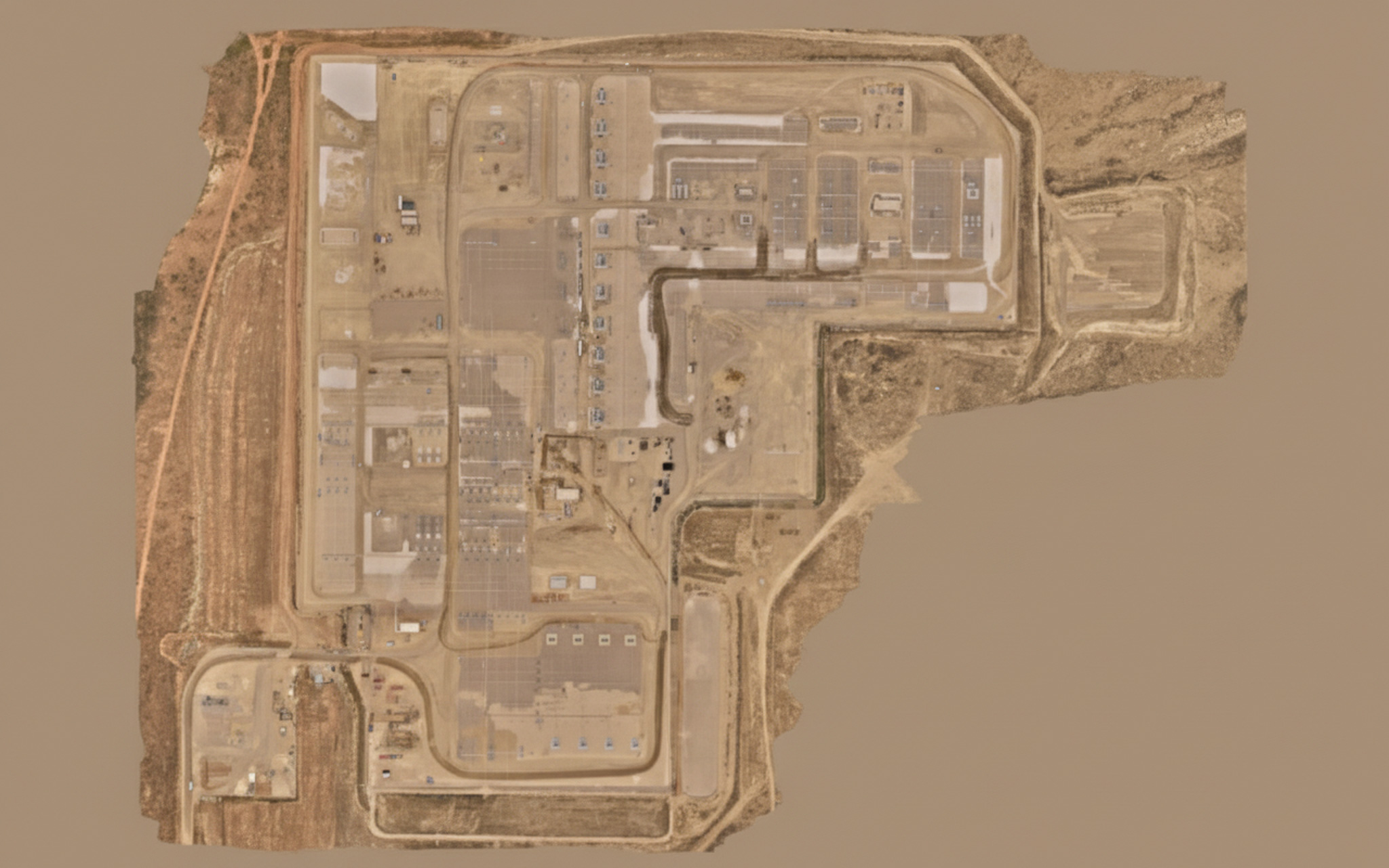
1. Instantaneous Site Topography
Instead of waiting days for initial surveys, our licensed operators can fly a site and gather millions of data points in under an hour. This data is immediately uploaded and processed to create a high-accuracy, 3D topographical model called an orthomosaic map.
This near real-time data allows our project managers to immediately pinpoint challenges, accurately plan drainage, and set up machine control with unmatched speed and precision.
2. Eliminating Guesswork with Digital Twins
The core of the savings comes from eliminating material guesswork. With the drone data, we create a Digital Twin of the job site. This allows us to compare the design plan against the actual terrain with centimeter-level accuracy.
- Accurate Cut/Fill: We generate highly accurate volume reports in hours instead of days. This prevents unnecessary over-excavation or under-ordering, which translates directly into savings on fuel, equipment hours, and material purchasing.
- Progress Tracking: Drones fly weekly, providing visual evidence and quantifiable data on earth moved. This allows for rapid verification against progress payments, ensuring all parties—GTPS, the utility, and financing partners—are working from the same verifiable data set.
The ROI: How Grade Tech Delivered $1.7M+ in Savings
On a large-scale substation and switchyard project, the efficiency gained through our drone mapping program delivered a massive return on investment.
Case Study Breakdown:
| Cost-Saving Area | Traditional Method | Grade Tech Drone Workflow | Saving Impact |
| Material Accuracy | Manual measurement errors leading to over-hauling/purchasing. | Centimeter-level accuracy on volume reports, optimizing every truckload. | $1,000,000+ in material and hauling costs avoided. |
| Survey Labor | Multiple crews performing initial, intermediate, and final surveys for weeks. | Drone operators performing all surveys in less than 2 hours per flight. | $300,000+ in survey labor and delays avoided. |
| Project Scheduling | Two-week turnaround for survey data processing. | Data processed and accessible to project managers/stakeholders in 24 hours. | Weeks shaved off the overall project schedule, maximizing equipment utilization. |
This quantifiable proof demonstrates that Grade Tech is not just a civil contractor; we are a technology-driven partner committed to maximizing your return on investment and minimizing risk.
Beyond the Bottom Line: Greater Client Transparency
While the cost savings are significant, the secondary benefit of drone mapping is transparency. Utility project managers gain access to the data instantly, viewing the project’s progress and material volumes from their desktop. This level of communication ensures absolute alignment, reduces conflict, and fosters stronger, long-term partnerships.
If your next power infrastructure project demands precision, speed, and proven financial savings, it’s time to move beyond the blueprint and partner with a team that has embraced the future of civil construction.
Ready to build your next utility site with maximum efficiency?
Contact Grade Tech Power Services


